Facts
Some facts about the UK and Uganda.

United Kingdom (UK)
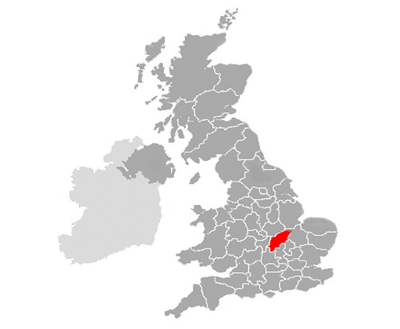
Location: North-west Europe
Capital city: London
Population: 60,975,400, the UK is the 22th largest country in the world.
Climate and landscape: the UK is 93,638 square miles.
Temperate climate: rainfall year round, mild temperatures.
Landscape: the UK is made up of one main island, with many islands in the north and territory in Northern Ireland.
Mainly lowland pastoral land in the south, with more mountainous landscape in the north.
History: the UK consists of England, Wales, Scotland and Northern Ireland. As the workshop of the world during the
industrial revolution, the UK led an empire ruling one quarter of the world’s population (including Uganda).
People: the main population group is white (92.1%) with a range of other groups.
Language: Official language is English.
Religion: 53% are Christian. 3% Muslim, with other religious groups and agnostics, atheists.
Economy: The economy is mainly based in the service sector ranging from financial services to tourism. The
manufacturing production includes food, chemicals and machinery. The main crops and livestock produced on UK farms
are: poultry, cattle and cereals.
Gross Domestic Product: £1, 213. 892m (5th largest in the world)
Currency: Pound Sterling
Northamptonshire
Northamptonshire is in central-eastern England. It is named after its main (county) town – Northampton. The county has over 629,676 people. The largest population group
in the district is white, there are also several other ethnic groups resident in the county.
Economy: Northamptonshire’s economy includes service, manufacturing and agricultural industries. The service sector is the largest in terms of economic
output, although much of the land in the county is used for agriculture. Several national warehouses and depots are located in the county. There is a cluster of world class
motorsport companies near Silverstone racetrack.
Transport links: Mainline railway to London runs through the county. The M1, directly through the county with the M40 just to the west. There are several
airfields in the county.


Uganda
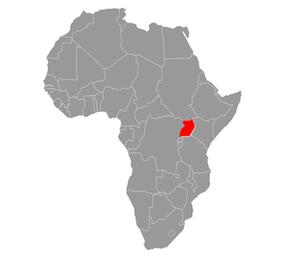
Location: Equatorial East Africa
Capital city: Kampala
Population: 28,247,300, Uganda is the 39th largest country in the world
Climate and landscape: Uganda is 91,135 square miles
Tropical climate: Rainy with two dry seasons. Average temperature between 20°C and 30°C
Landscape: includes volcanic ranges and green plateau. Uganda borders Lake Victoria, with the source of the Nile running from Jinja.
Churchill once remarked that with all it’s stunning landscape Uganda was the “pearl of Africa”.
History: Uganda is a former British colony. Uganda gained independence in 1962, but has experienced several conflicts and episodes of
violence especially during the dictatorships of Amin and Obote. More recently Uganda has become a relatively peaceful and democratic
place, with the reforms of President Museveni.
People: A wide range of different ethnic and tribal groups live in Uganda.
Language: Main languages spoken are English, Luganda, Swahili and several other indigenous languages.
Religion: 67% of the population is Christian, 12% are Muslim, although indigenous religions are also practiced together.
Economy: The economy is mainly agricultural, producing: coffee, tea, cotton, tobacco, cassava, potatoes, flowers, poultry and goats.
Gross Domestic Product: £4,810m (109th in the world)
Currency: Ugandan Shilling.
Jinja District
Although the second smallest district in Uganda, Jinja district has one of Africa's highest population densities.
It is named after its main city – Jinja. The district has over 413,937 people. The largest population group in the district is Bantu,
although there are also several other tribal groups and an Indian group.
Economy: Lake Victoria is important to the surrounding region. Fishing and boat building take place on the Nile and on the Lake.
Farming thrives because of the fertile soils, plentiful water sources and reliable rainfall of the area. Around Jinja itself, more industrial
activity takes place including: metal, leather and paper processing, grain milling, sugar refining and brewing for local sale.
Two hydro electric dams (The Owen Falls / Nalubaale and the Kiira Dam) provide a significant source of power for the country.
Transport links: a rail line runs through the district from Kampala to Iganga. The district has both tarmac and murram roads. It is
linked to Kampala, Kamuli, Mayuge and Iganga Districts by tarmac roads. There is an airfield near Jinja.
